Visiting Picturesque Miyajima Island
Miyajima Island has long been a draw for tourists and locals alike for its serenity, nature, and shrines. Visitors are consistent in voting Miyajima Island one of the top scenic spots in Japan. A quick look on a map and you’ll find that Miyajima’s actual name is Itsukushima. In Japanese Miyajima means Shrine Island, and the nickname has stuck. With easy access by boat, Miyajima Island makes for a perfect day trip when visiting nearby Hiroshima.

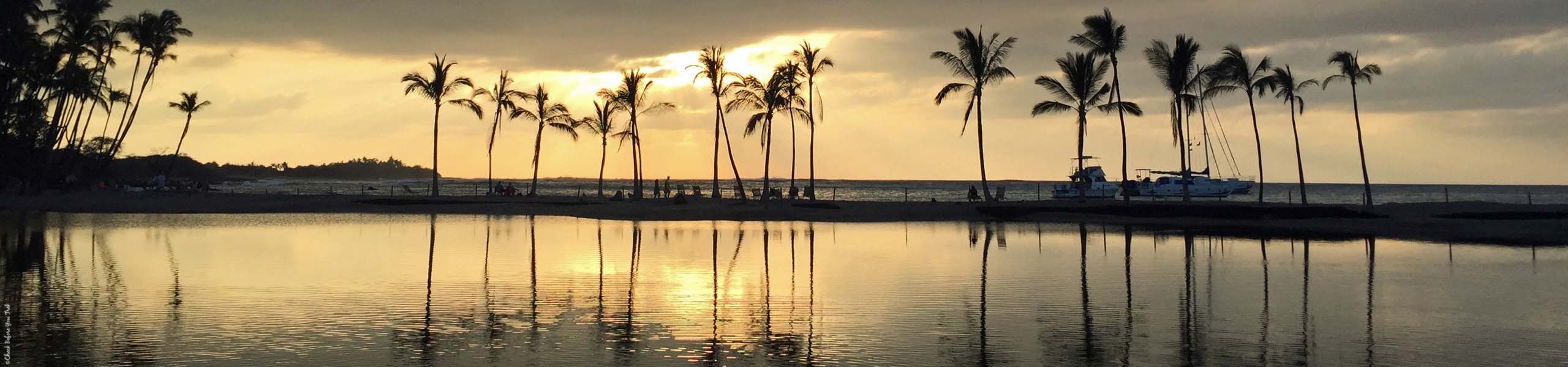
Sunset on Miyajima Island
Traveling to Miyajima Island
You’ll find Miyajima Island in Hiroshima Bay. Travelers visiting Hiroshima can add an extra day in the region to visit Miyajima Island. It is easy to reach Miyajima Island from Hiroshima. The trip is less than an hour and makes for a perfect day trip. Visitors will reach Miyajima Island from Hiroshima by train and boat.
To reach Miyajima Island most visitors in Hiroshima will board the JR Sanyo Line to Miyajimaguchi Station. The JR Line is the fastest way to reach Miyajimaguchi Station. The popular Japan Rail Pass that many tourists use to travel around Japan covers the JR Sanyo Line. Those that did not buy a Japan Rail Pass have two options to reach Miyajimaguchi Station. The fastest route is to buy a round trip ticket for the aforementioned JR Sanyo Line. The cheaper, and slower, alternative is to take the Number 2 Tram Line from central Hiroshima bound for Miyajimaguchi.
Upon reaching Miyajimaguchi Station follow the signs to the Miyajimaguchi/Miyajima Ferry Port. This short walk leads you to the boats sailing to Miyajima Island. At the Port, Japan Rail Pass holders may use the entrance marked JR and board the next available boat bound for Miyajima Island. Those without a Japan Rail Pass will need to buy tickets at the nearby kiosk for the next available sailing.
Travelers without a Japan Rail Pass can reach Miyajima Island without boarding a train. Two other docks, at Hiroshima Peace Park and Hiroshima Port, offer direct boat rides between Hiroshima and Miyajima Island.


Arriving at Miyajima Island
Regardless of which boat you take to reach Miyajima Island you will disembark at Miyajima Pier. From the Pier turn right and walk along the path next to the waterfront. As you walk along the path, and throughout Miyajima Island, you may come upon deer roaming free. These deer appear tame and comfortable around humans, as long you do not bother them. Visitors enjoy taking photos with the deer, but be sure to treat the animals with care. Remember, the deer are wildlife. Approach the deer with caution, stay at a safe distance, and do not touch or feed the deer. The deer will eat paper tourists are holding in their hands. Be mindful if you are holding maps or brochures near the deer.
To the left of the waterfront pathway you will find local owned businesses on the streets of Omotesando and Machiya. Miyajima artisans are fond of using wood to create everything from trays to containers. You can even find pieces of woodwork with etchings of various Miyajima sights. Rice scoopers are one popular item the wood makers craft. As you walk among the stores keep an eye out for a display featuring the largest rice scooper in the world.


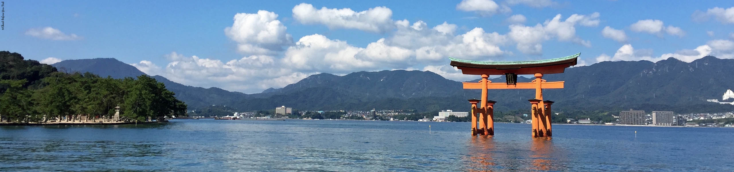
Itsukushima Shinto Shrine
At the end of the streets with stores and restaurants you will come upon Itsukushima Shinto Shrine. The Shrine’s buildings, along with the nearby Five-Storied Pagoda and O-Torii, have the honorable designation of being a UNESCO World Cultural Site. Most visitors are familiar with Miyajima Island because of the O-Torii, or Grand Torii Gate. The O-Torii is first visible from the boat one takes to reach Miyajima Island.


Viewing the O-Torii is a different experience depending on whether you visit during low tide or during high tide. Upon disembarking from the boat that brought you to Miyajima Island visit the nearby Information Booth for a posted sign with times for low and high tide. Pre-planners can find tide times posted online if you need to know the times before your visit. High tide is the perfect time for photos as the O-Torii sits surrounded by water. Low tide offers visitors the chance to see the O-Torii up close as you may walk up to the Gate. The ground is wet, muddy, and slippery, so wear proper shoes for the walk to the O-Torii during low tide.


Mt. Misen (the Sacred Mountain) and Observatory
Included in the World Heritage designation is Mt. Misen, known as the Sacred Mountain. The landscape of the Island has drawn many spiritual beings to Miyajima. As you hike Mt. Misen, you will find large rocks and trees amidst temples and religious statues. To hike any part of Mt. Misen requires being in good physical health. It is possible to hike from the base of Mt. Misen to the top. Most visitors will ride the Miyajima Ropeway, which will allow you to bypass a large part of Mt. Misen. From the waterfront follow the signs to the Momijidani Station and use the Ropeway to reach either Kayatani or Shishiiwa Station.


Even taking the Ropeway to the furthest point, Shishiiwa, still leaves hikers with a strenuous trail to the top most observation deck. The reward in reaching the observation deck is stunning views of Seto Inland Sea and the surrounding Islands.


Daishoin Temple
With its deep connection between nature and spirituality, Miyajima is home to many temples. One in particular, Daishoin Temple, is one of the grandest on Miyajima Island. The grounds for Daishoin Temple makes it one of the larger temples to explore on Miyajima Island. The easiest way to locate Daishoin is if you position yourself with the Miyajima Ropeway behind you, and the O-Torii Gate in front of you. At that point turn left to reach Daishoin. Take your time walking and admiring the serene grounds, various halls, and thousands of religious statues.
loading map - please wait...
Visiting Picturesque Miyajima Island Miyajima, Japan | |
Visiting Picturesque Miyajima Island Miyajima, Japan | |
Visiting Picturesque Miyajima Island Miyajima, Japan | |
Visiting Picturesque Miyajima Island Itsukushima Island 広島県, Japan | |
Visiting Picturesque Miyajima Island Miyajima, Japan | |
Visiting Picturesque Miyajima Island Miyajima, Japan | |
Visiting Picturesque Miyajima Island Miyajima, Japan | |
Visiting Picturesque Miyajima Island Miyajima, Japan | |
Visiting Picturesque Miyajima Island Miyajima, Japan |